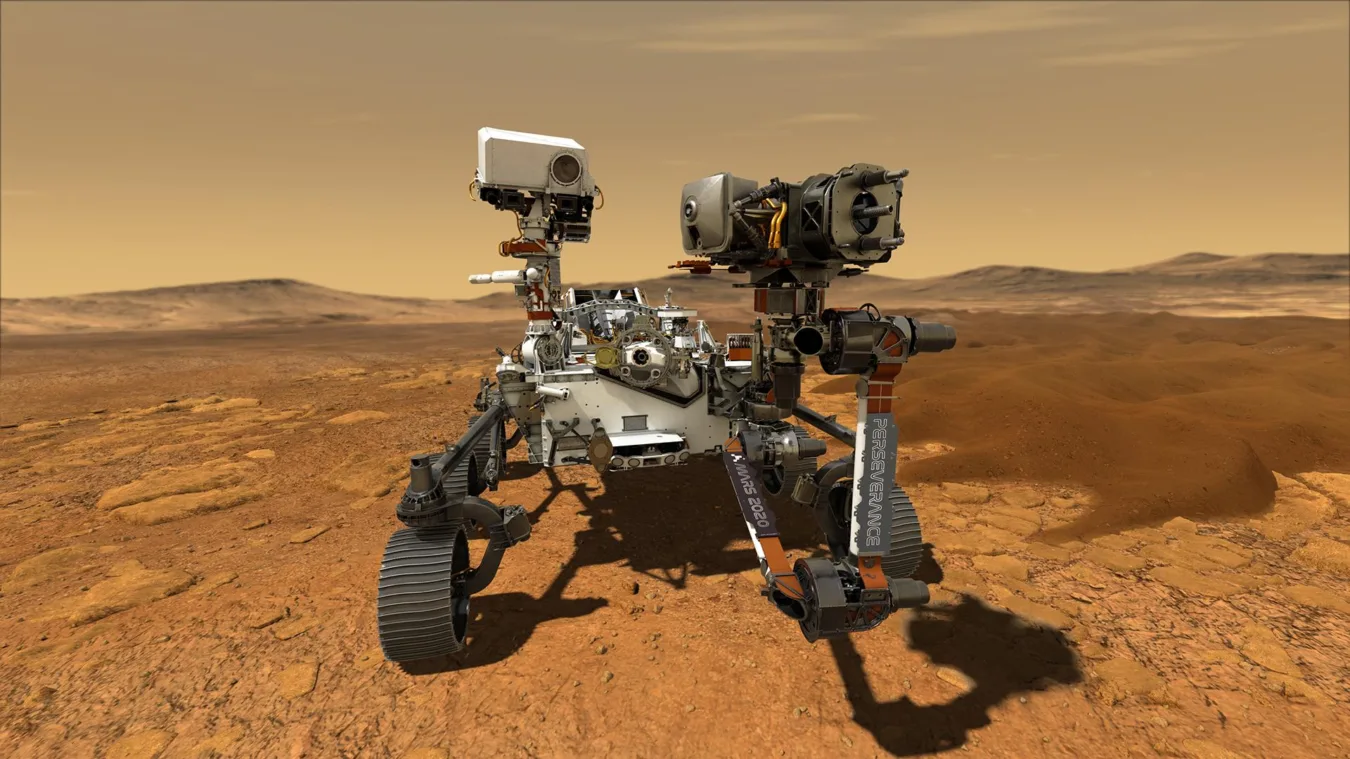
 Jezero crater is a unique location to study evidence of past life on Mars (Photo Credit: NASA/JPL)
 We’ve all seen the majestic images of the Martian surface sent back to us by NASA’s Perseverance Rover. But what most people don’t realize is that the intrepid little rover carries another imaging tool. Known as RIMFAX (the Radar Imager for Mars’ Subsurface Experiment), researchers from UCLA’s Department of Earth, Planetary and Space Sciences have captured the most detailed images ever of another planet’s subsurface ever reported, down to 120 feel below ground. In doing so, they identified the buried remains of an ancient river delta on Mars’ Jezero crater.
The work was led by planetary scientist Dr. Emily Cardarelli, a member of the UCLA Space Institute and a researcher in the EPSS department. Scientists have long suspected that Jezero crater once held a lake fed by rivers; that was one of the main reasons NASA chose it as Perseverance’s landing site. Orbital imagery had already shown a prominent delta within the crater. But the radar data the team analyzed revealed something more: evidence of an older, buried delta 80 feet below the Martian surface.
The study, published March 18 in Science Advances, draws on data collected as Perseverance traversed up the crater. Each time the rover drives, RIMFAX sends radar pulses downward and records the returning reflections, allowing researchers to reconstruct layers hidden below the rover’s path and see how they are arranged in three dimensions. In the sections Cardarelli analyzed, the instrument reached deeper than anywhere else examined during this part of the rover’s traverse, revealing a striking record of layered sediments and erosional surfaces.
“This instrument allows us to actually see structures beneath the ground of another planet,” Cardarelli said. “It’s not every day that you get to look underground on Mars.”
What emerged was not simply more evidence that water once moved through Jezero, but a more specific picture of how. The radar profiles show inclined layers and depositional geometries consistent with sediments laid down where flowing water entered a standing body of water — the kind of internal structure geologists would expect from an ancient delta. The data also indicate that these older deposits were later eroded and then overlain by younger materials, pointing to a more complex history than the visible landscape alone suggests.
“If we are ever going to find conclusive evidence for life, or land humans on Mars, we need to know the hydrological history of Mars, not just on the surface but many meters below the surface,” said Ranga Ram Chary, executive director of the UCLA Space Institute. “These pioneering measurements are most efficiently done by cutting edge instrumentation on robotic explorers like the Perseverance rover many decades before a human landing party.”
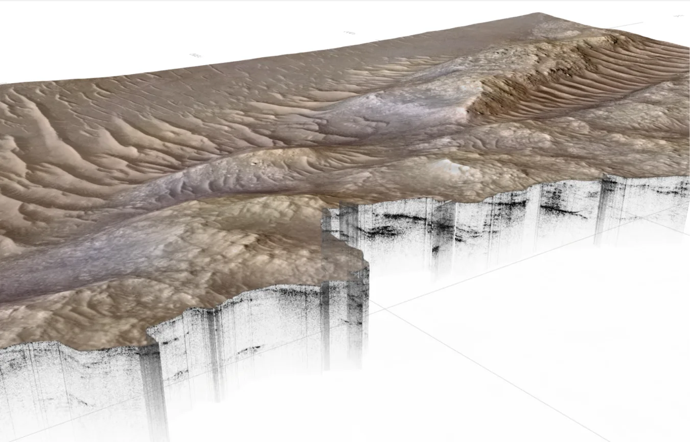
A cross-section into the Margin unit within Jezero crater, more than 35 meters below ground. RIMFAX has revealed an earlier subsurface deltaic environment under the present-day delta, thereby extending the period of potential habitability back further in time. Credit: NASA/JPL/UCLA/UiO/ETH Zurich
One of the most impressive images the researchers captured links radar reflections below ground to topographic expressions visible above it. In effect, the figure shows how layers traced in the radar extend into features exposed in the landscape today, helping the team connect buried stratigraphy to landforms the rover can actually see with other payload instruments.
That connection matters because it strengthens the geological interpretation. Rather than relying on appearance alone, the researchers were able to follow the structure through the rock record itself.
Cardarelli, who joined the department in 2023, did not begin her career in planetary geophysics. Her earlier research focused on subsurface microbial communities in river systems in the western United States. This experience now informs how she interprets evidence of ancient river environments on Mars. “Studying river systems on Earth taught me how the movement and flow of water can create structures and ecological niches,” Cardarelli said. “I never thought I would be applying that perspective to ancient rivers on Mars, but it has been an exciting new challenge for me.”
On Earth, river deltas are dynamic settings that can concentrate sediments, preserve environmental history and create niches favorable to microbial life. That makes them especially important targets in the search to understand whether Mars once hosted habitable conditions.
“We know how important river systems are for building landforms and sustaining ecosystems,” Cardarelli said. “Seeing similar fluvial structures preserved in the Martian rock record tells us that environments capable of supporting life may once have existed there.”
UCLA’s EPSS department is playing an important role in a fast-developing area of planetary science. Cardarelli’s paper is among the first in what she described as a new frontier in planetary geophysics: using rover-based ground-penetrating radar to interpret the hidden architecture of another world.
RIMFAX was funded, developed, and delivered by FFI (by the Norwegian Defence Research Establishment) with additional support from the Norwegian Space Agency. The instrument’s principal investigator is Dr. Svein-Erik Hamran of the University of Oslo, and Cardarelli worked closely with collaborators across the international RIMFAX team. The research was supported in part by NASA and the Research Council of Norway.
As Perseverance continues its trek through Jezero, it is collecting radar profiles with every drive. For Cardarelli and her colleagues, that means the buried record of Mars is still waiting to be discovered — layer by layer.